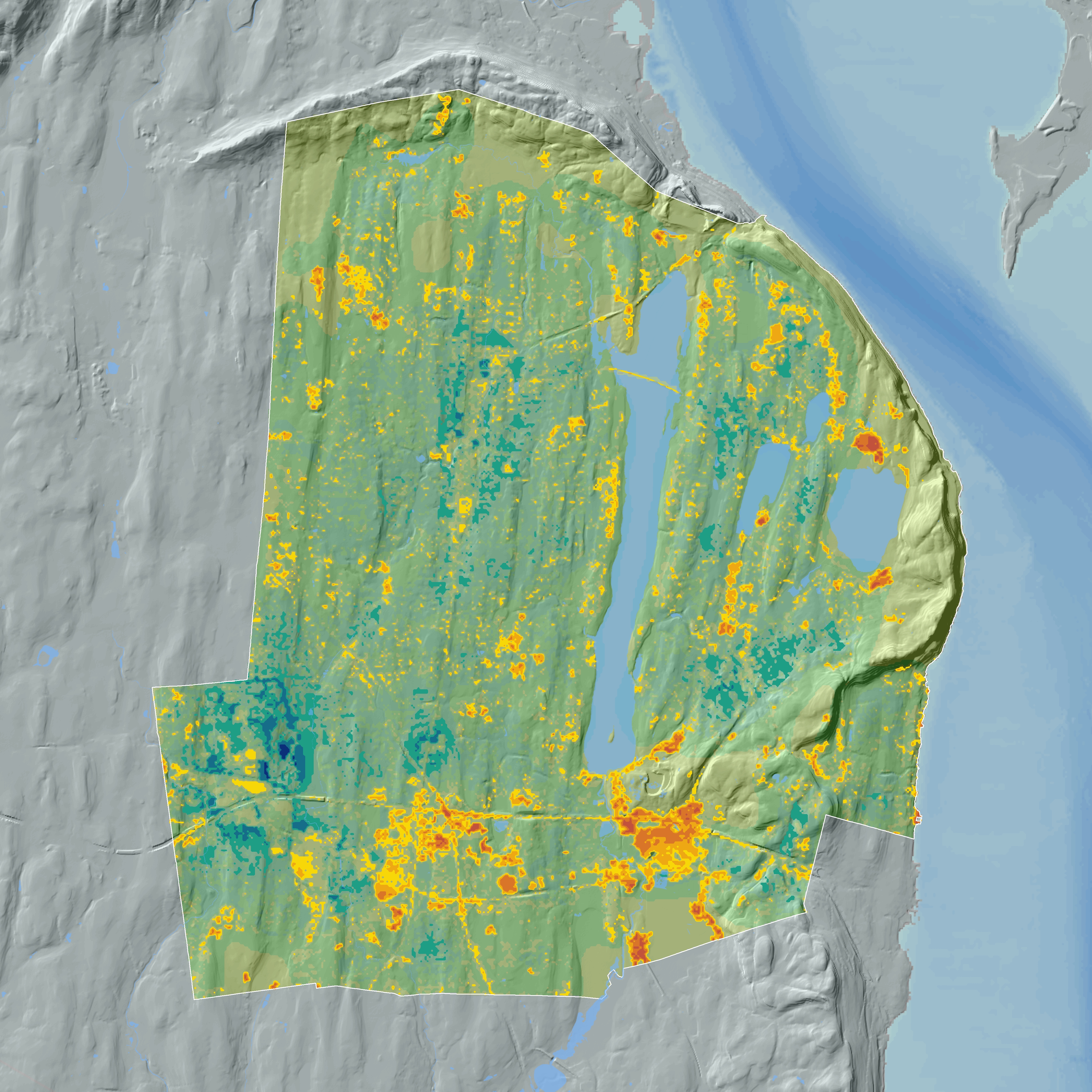
︎︎︎ Impervious Surface Analysis
Responding to the needs of a municipal planning department, this projected analyzed current stormwater sewer system capacity in relation to surface permeability.
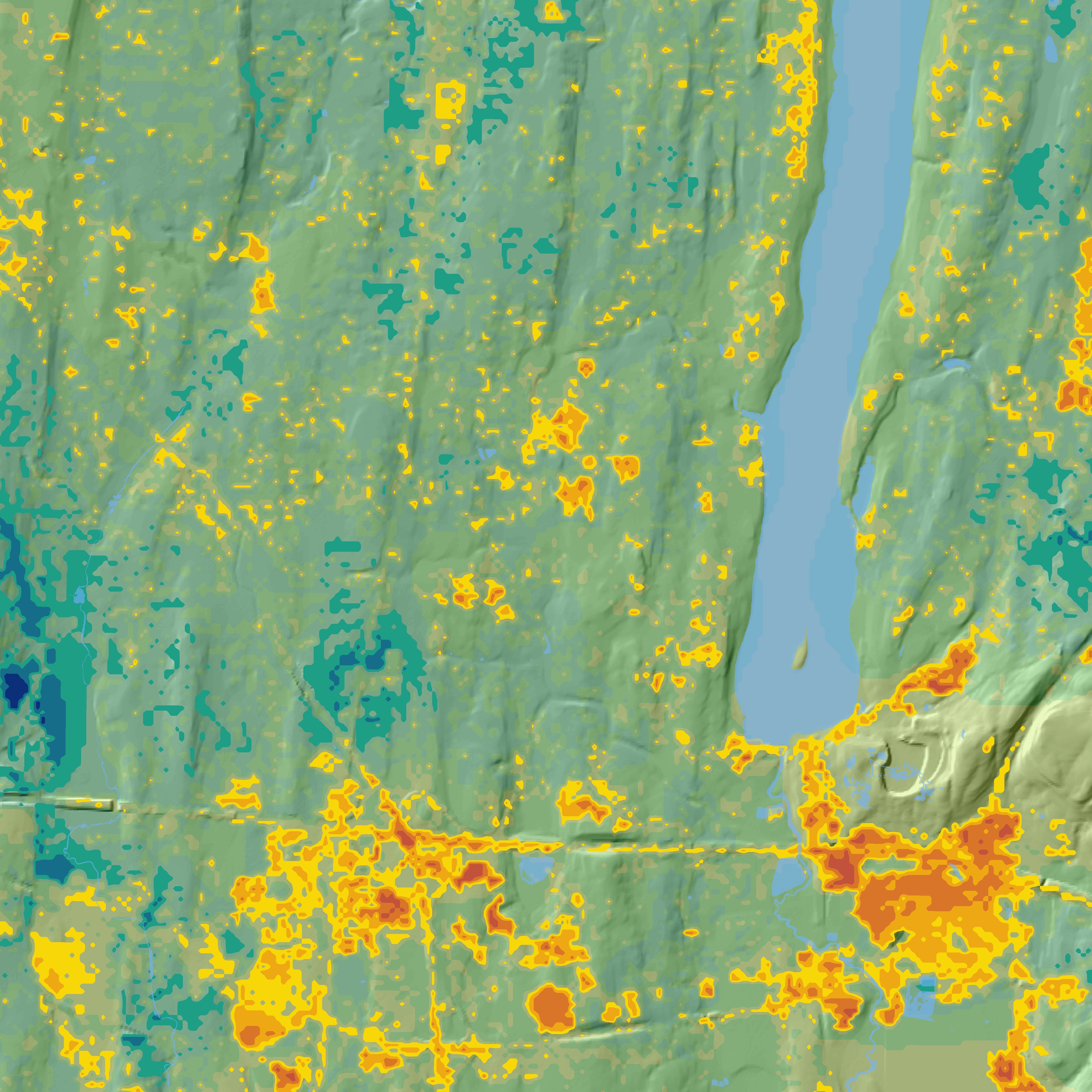
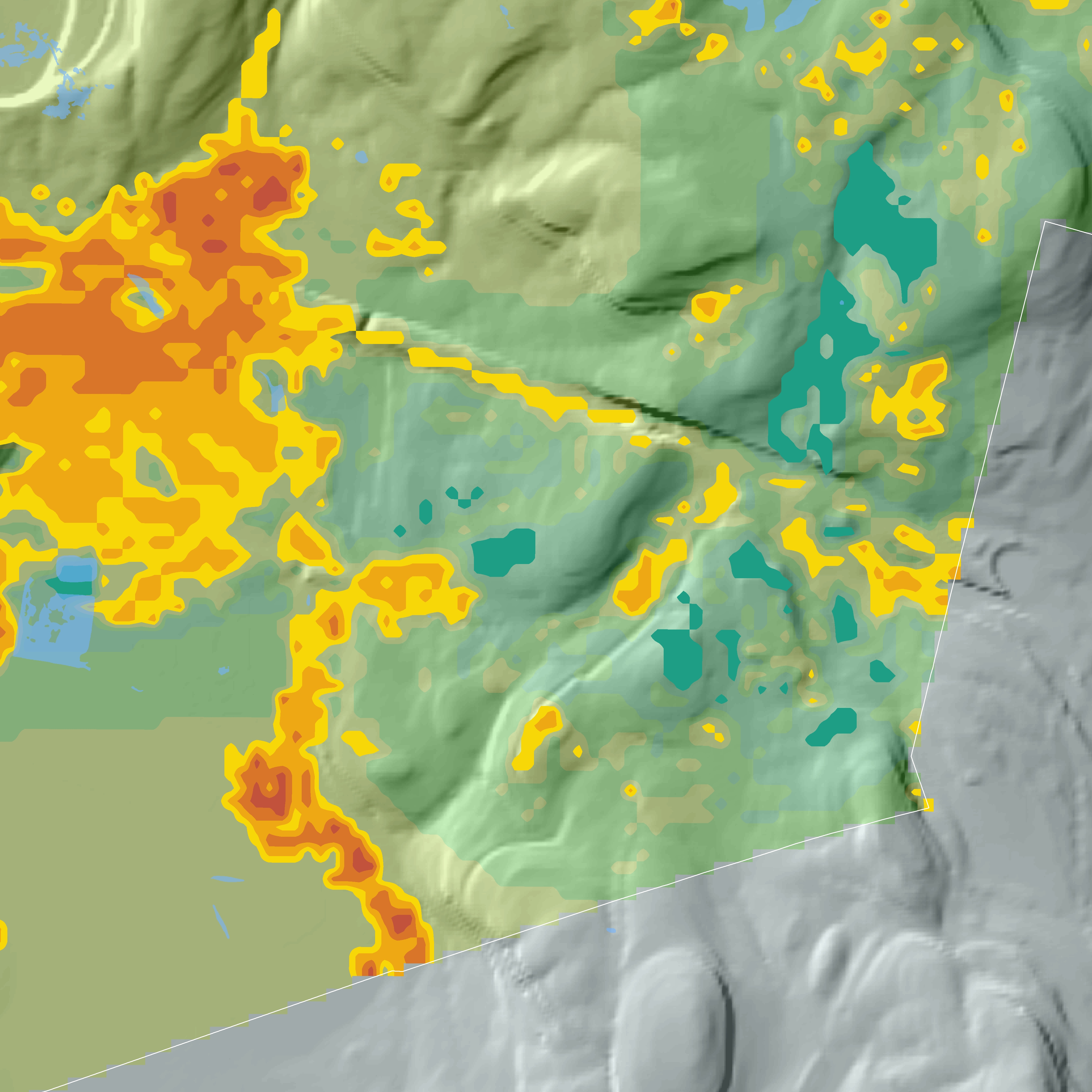
Combining surface permeability data from the National Land Cover Database and FEMA’s National Flood Hazard Layer data, with proprietary municipal MS4 location and size information, this project created a comprehensive heat map indicating optimal siting for new capital improvements to the stormwater discharge system.
Optimal locations for new construction can be seen in red, as indicated by a high imperviousness index located within a FEMA floodplain, and a low density of MS4 infrastructure. Conversely, areas which are currently more than sufficiently served by existing infrastructure can be seen in blue.