︎︎︎ Municipal Seperate Stormwater Sewer System (MS4) Survey
Responding to the needs of a municipal planning department and a county stormwater consortium, this project combined the collection of spatial and tabular data of a large municipal stormwater drainage system, culminating with the production of an interactive 3D model and presentation.
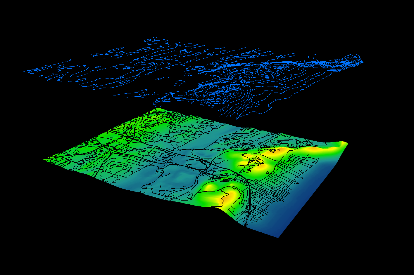
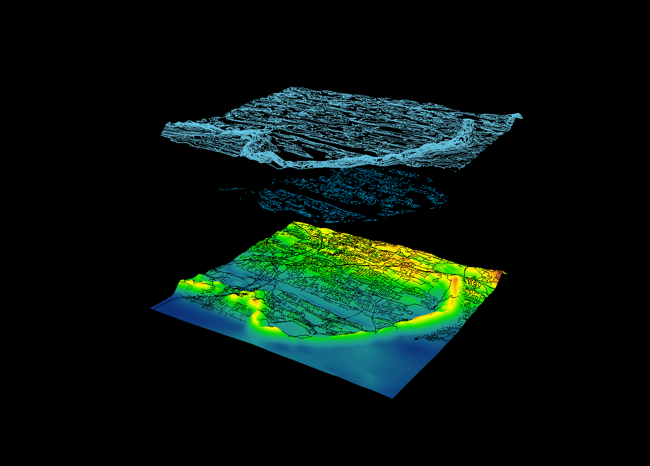
Elevation, road, and parcel data were gathered from surveying consultants, while municipal seperate stormwater sewer system (MS4) depth, direction, and other spatial attributes were collected by extensive first-hand fieldwork.
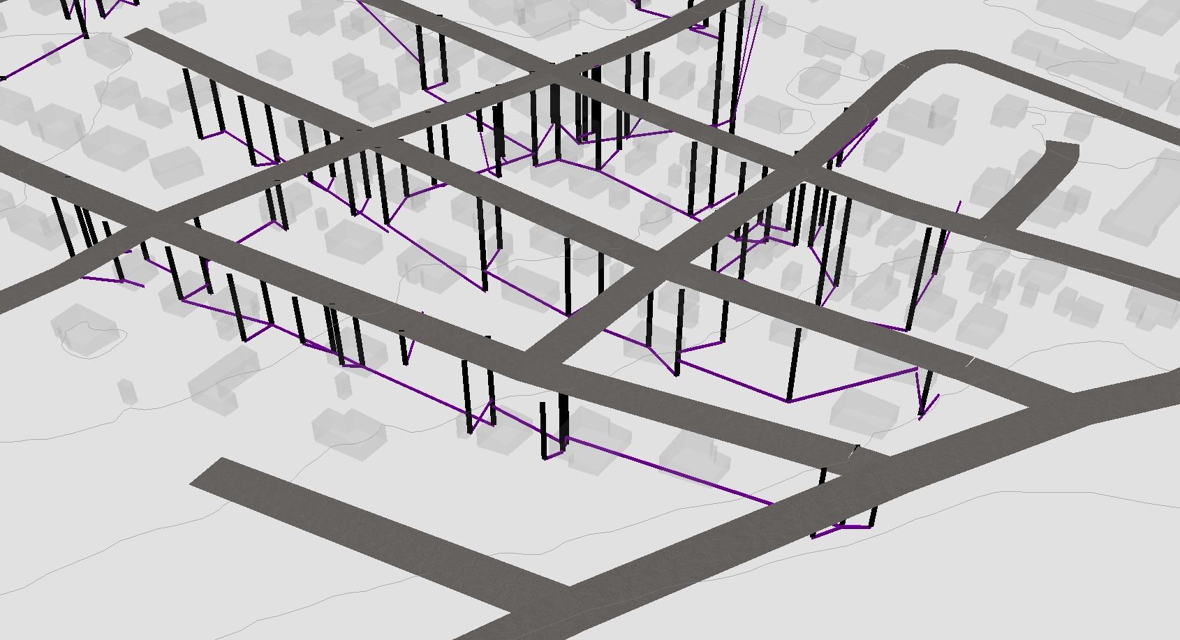
Datasets totaling over ten-thousand entries were topologically synthesized in a GIS environment to created a complex geometric network. This system was subsequently reviewed for data accuracy and validity using a host of user-defined parameters.
Additionally, an in-depth digital presentation was created to showcase results and educate the public on the value of an MS4 system.
Presentation ︎
Public Web Page ︎
To augment data collection and analysis in municipalities with similar infrastructure, a guide book detailing effective quality control for geospatial data was also produced and shared freely.
Data Review Guide ︎