︎︎︎
Fiscal and Land Use Options for Coastal Adaptation
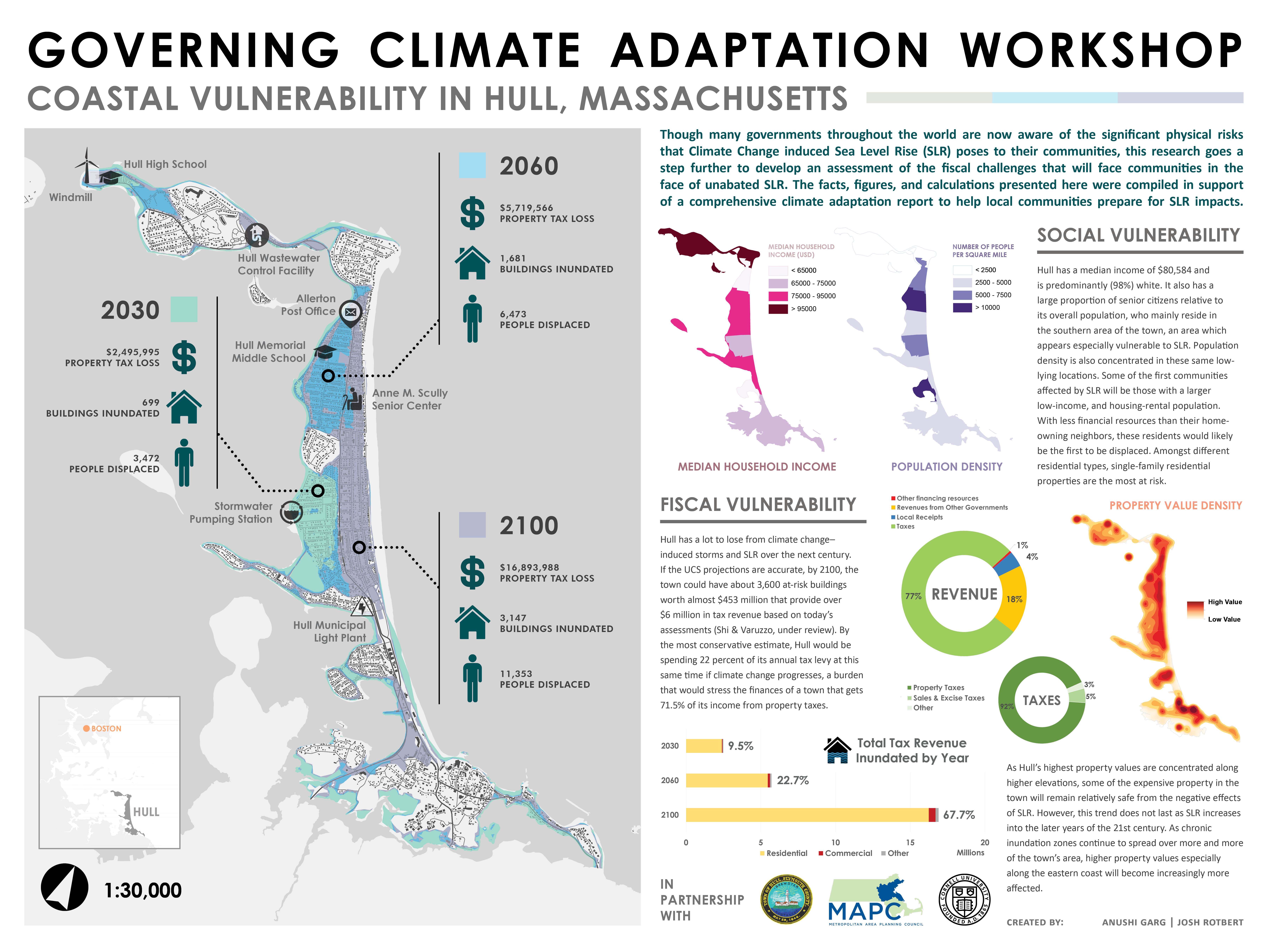
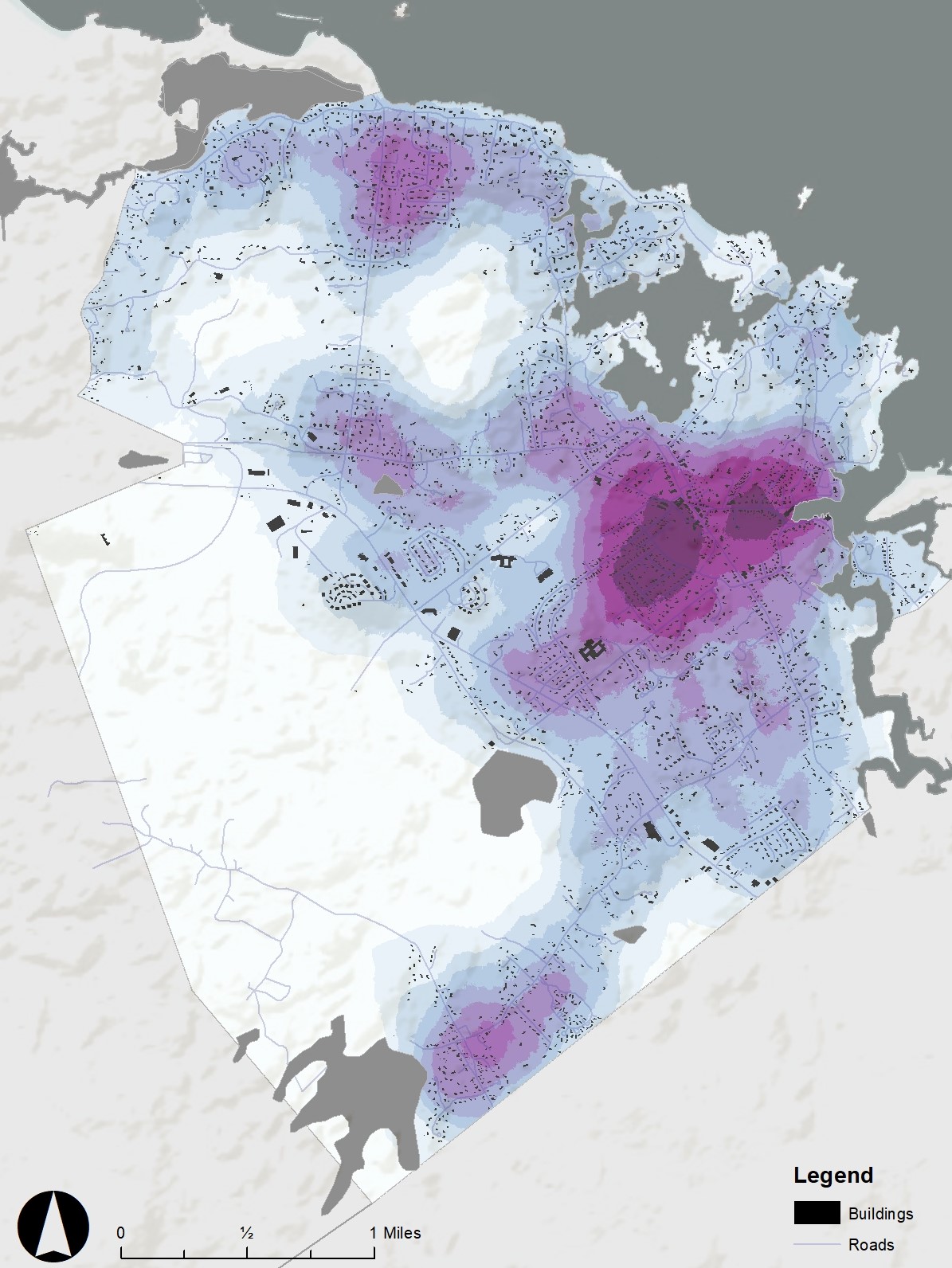
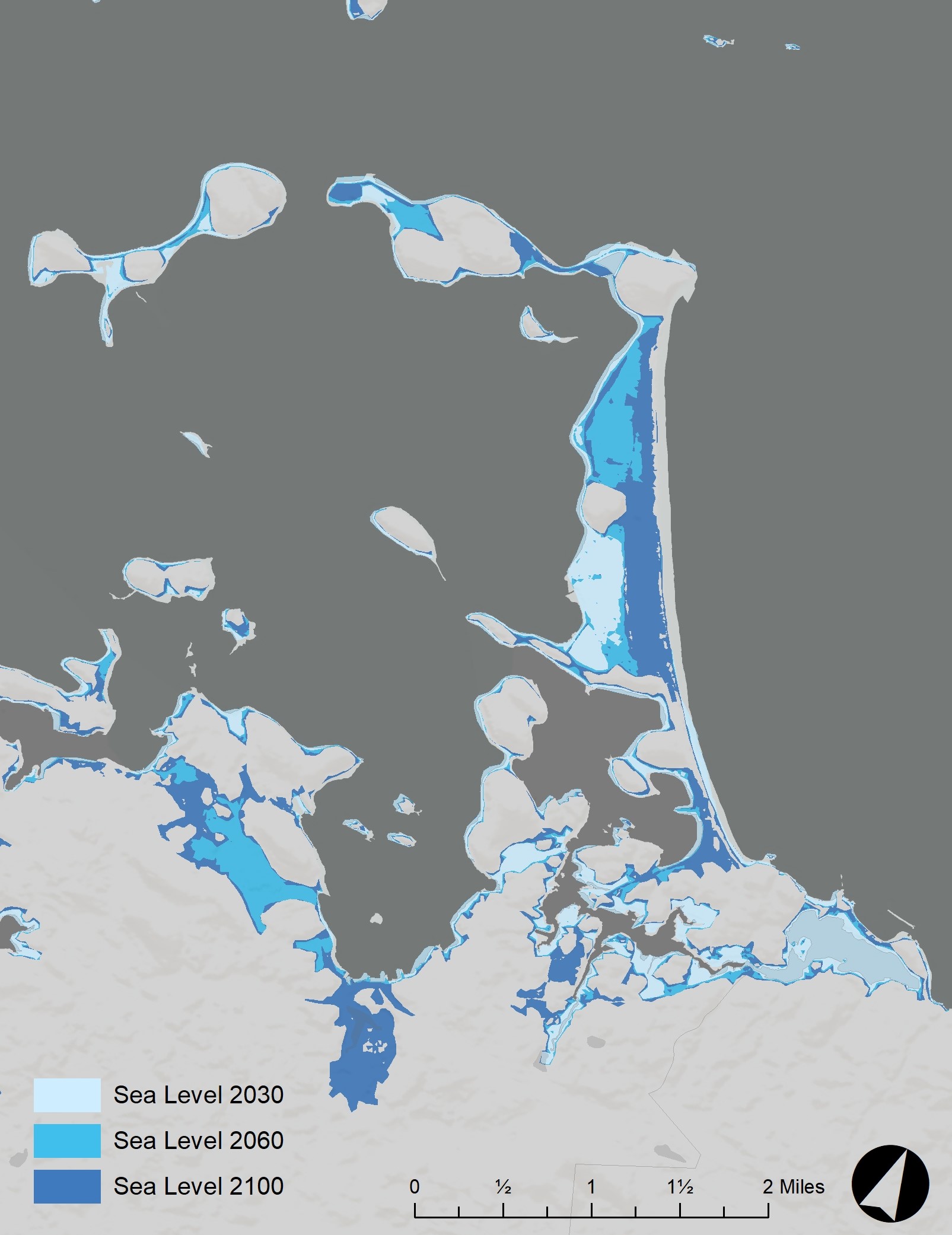
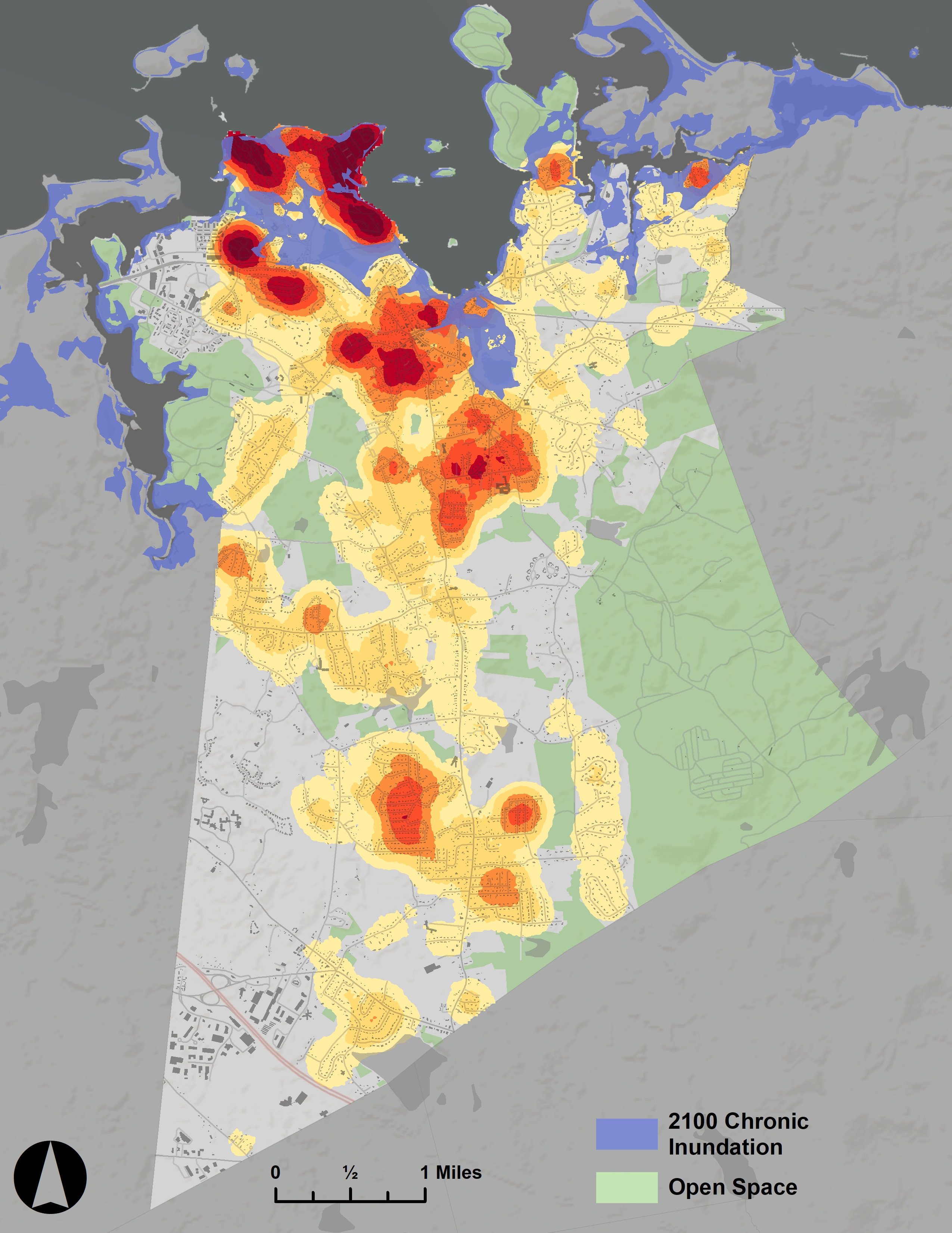
The product of a workshop course in the Department of City and Regional Planning at Cornell University, this project measures the fiscal impact of sea level rise, in relation to a set of student-developed land use planning scenarios in support of climate adaptation. A comprehensive vulnerability assessment was first developed using GIS to outline potential fiscal, social, and physical risk. This data was subsequently employed to develop tools and models that informed potential fiscal and land use policy proposals. Students tackled questions related to climate change adaptation in the context of three coastal towns – Hull, Hingham, and Cohasset – located south of the City of Boston, Massachusetts. Final products are a result of collaboration between Boston’s regional land use agency, the Metropolitan Area Planning Council (MAPC), and a graduate-level workshop course with 11 students from Cornell University’s Department of City and Regional Planning (CRP).
Link to Full Report ︎